Home » What We Do » Global Health » HIV and AIDS » Technical Areas » HIV/AIDS Data Use and Analytics
- What We Do
- Agriculture and Food Security
- Democracy, Human Rights and Governance
- Economic Growth and Trade
- Education
- Ending Extreme Poverty
- Environment and Global Climate Change
- Gender Equality and Women's Empowerment
- Global Health
- Water and Sanitation
- Working in Crises and Conflict
- U.S. Global Development Lab
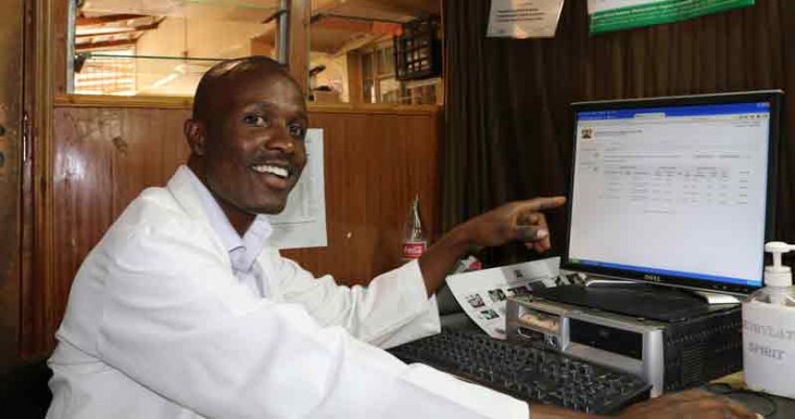
Photo credit: Faith Njoki Njung'e/USAID
The U.S. Agency for International Development (USAID) uses innovative strategies to monitor and combat the HIV/AIDS epidemic. From electronic data collection tools that allow for better-organized data collection and storage, to new analysis tools, to geographic information systems, USAID is taking advantage of new and innovative approaches to target our interventions to help control the HIV/AIDS epidemic.
USAID supports program monitoring and data-driven decision-making through:
- Routine Monitoring for HIV/AIDS: USAID strives to collect and use data to control the HIV epidemic by doing the right things, in the right places, at the right time. The Agency works to build the capacity of USAID missions to effectively manage their data collection and use processes and systems in order to provide accountability, oversight and management of programs and partners. As innovative approaches to HIV programming are developed, analysis of quantitative and qualitative data helps build the evidence base of what works to deliver efficient, life-saving HIV/AIDS programs.
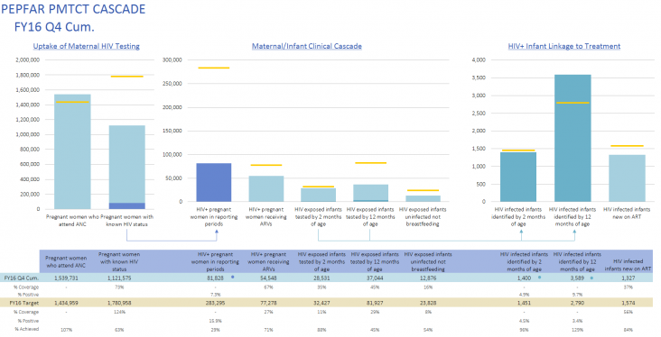
Graphics, like the one above, show annual progress along the HIV prevention-to-treatment cascade.
Source: Interagency Collaborative for Program Improvement Preventing Mother to Child Transmission Workstream
- Geographic Information Systems (GIS): In alignment with the core principles of the U.S. President's Emergency Plan for AIDS Relief (PEPFAR) 3.0 [PDF, 1.2MB], USAID's HIV/AIDS program uses geography as a primary framework for planning and monitoring. Mapping and geospatial analysis can improve program operations, enhance reports and provide new insights into programmatic challenges. USAID supports headquarters and missions in the collection, management and analysis of geospatial data to improve the overall effectiveness and efficiency of USAID's PEPFAR development assistance.
- In order to support a sustainable response, investments must track where the need is. To do this, USAID and implementing partners must understand the epidemic and monitor programs. USAID country teams incorporate this type of geographic alignment analysis in their country operational plans each year, as shown in this example from Kenya:
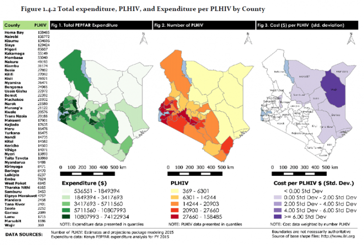
The map series above illustrates how country teams analyze their programs to ensure program implementation and resources are where they are most needed.
Kenya Country Operational Plan, 2016 [PDF, 2.1MB]



Comment
Make a general inquiry or suggest an improvement.