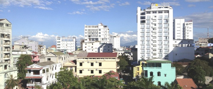
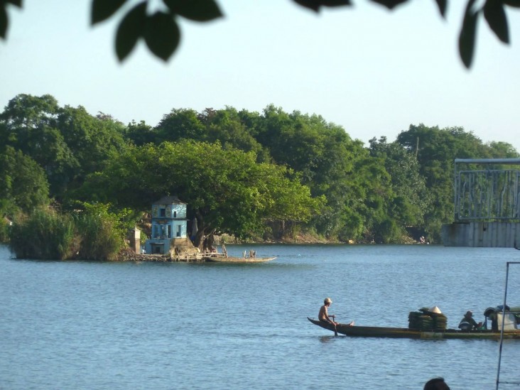
 Southern downtown section of Hue
Spencer Reeder, Cascadia Consulting
 Southern downtown section of Hue
Spencer Reeder, Cascadia Consulting
The 340,000 residents of the coastal city of Hue in central Vietnam enjoy a slower pace when compared to the hustle and bustle of Ho Chi Minh City and Hanoi. Hue holds both cultural and economic significance, and is home to the imperial grounds and residences of the Nguyen Dynasty, a major tourist attraction and UNESCO World Heritage Site.
A few times each year, this relative calm is interrupted by large rain events—often associated with typhoons—that cause significant flooding. The floods of 1999 and 2006 were particularly bad, completely inundating thousands of homes throughout the city and the surrounding province.
“Flooding in most homes is common two to three times a year, up to knee height,” says Nguyen Cong Son, a university student in Hue.
“In a typhoon, water comes from the mountains, very quickly. I have two floors, but some people have only one floor,” says Tung*, a local resident. “In 1999, about 28 people died.”
In 2006, the entire city was again paralyzed for days, submerged under more than 6 feet of floodwater. In addition to ravaging homes, heavy rains also damage public and commercial infrastructure, and bring dysentery and other waterborne illnesses. Because the city is a major transportation hub—with a recently renovated airport, the main rail corridor for passenger and freight trains, and a major north-south highway—disasters in Hue can also disrupt commerce and have other impacts further afield.
The road network itself can contribute to the problem: As it has been expanded in recent years, the area’s natural drainage capacity has diminished.
Disasters like these are projected to worsen as the climate continues to change. Extreme heat and sea level rise are also a growing concern.
“These escalating disasters will hamper Vietnam’s ability to fight extreme poverty and to continue on its path to becoming a middle income country,” says Veronica Lee, an environment officer at USAID/Vietnam. “The Government of Vietnam has therefore identified climate change as a priority area for development assistance. Our programs aim to help the country grow sustainably in the face of these challenges.”
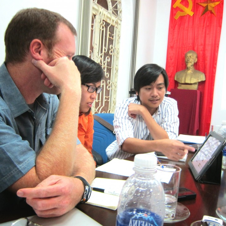
In 2012, USAID began helping Hue anticipate and address the repeated flooding and other climate impacts on critical infrastructure like roads and energy systems. Under USAID’s Climate Change Resilient Development program, Cascadia Consulting Group has been working with local planners at the Hue Planning Institute (HPI) to customize and apply a tailored software tool to help urban planners think about climate change.
The Climate Impacts Decision-Support Tool brings together information about the impacts of climate change—information that is typically found in multiple places and is hard for non-scientists to interpret—into one place, using more accessible language. The tool also uses the findings of a climate vulnerability assessment conducted under USAID's Mekong-Building Resilience in Asian Cities (M-BRACE) program.
Planners can input the type, intended lifetime (from 2030 to 2090), and preferred location of their infrastructure project, and quickly find out what climate change impacts they need to worry about, and what the city recommends they do about it in their project design and siting decisions. HPI and other local government agencies helped to refine the contents of the tool to ensure that the climate information and guidance for planners was both locally relevant and validated by the government.
With information about how climate change will affect the severity and frequency of flooding, and which sites will be most vulnerable, city officials can also make better decisions about which parts of the city—and surrounding areas—are safe to develop more intensively as the population grows.
“A couple of years ago, I would have never thought about climate change during the planning process,” says Dang Minh Nam, director of HPI. “A workshop on climate change I attended last year changed my mind. Now the tool pushes me even further. Local investors, residents and other stakeholders deeply care about what will happen to their infrastructure in the future. The tool helps us planners show them how climate change will affect infrastructure in 30, 50 and 70 years, so that they can make good decisions.”
Moving Residents Inland
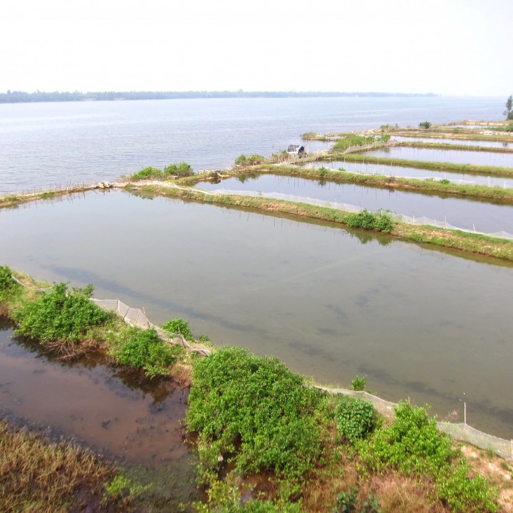
HPI found that the tool was immediately useful in crafting a new urban master plan for a rural area known as the Vinh Thanh commune, located between a lagoon and the South China Sea. While current residents rely mostly on agriculture, fishing and farming shrimp, mollusks and crabs, this area had been identified as a good place for a new urban development.
HPI created an urban master plan with revamped areas for tourism, and for industrial, agricultural and residential zones. Cascadia’s team helped customize the climate tool and trained staff to apply it to the master planning process.
Based on information from the tool, HPI decided to change where the new residential zone would be located, moving it inland, farther from the coastline and the lagoon. As a result, residents and their homes will be more protected from destructive storms and typhoons, which are expected to become increasingly severe as the climate changes.
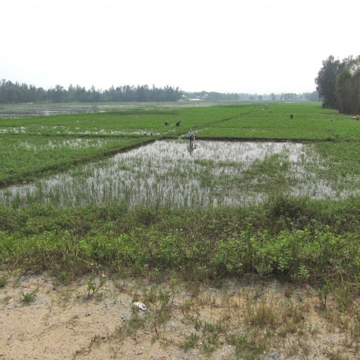
HPI also reconsidered its plans for a low-lying area between the lagoon and the coast, which is currently covered by hectares of rice paddies. Intrusion of saltwater into these lowlands has made it harder to grow rice, so the planners were weighing different options for new uses for that land, from cultivation of other vegetable crops to eco-tourism.
However, insights from the USAID-supported tool suggested that such low-lying areas are best kept as green space, to allow for adequate drainage or storage of floodwater during storms. HPI decided to preserve most of the area for ponds and lakes, and promote some farming of crops that can tolerate more salt.
Simple and User-Friendly
The tool is designed to be simple and user-friendly, and it takes only 15 minutes to look up the necessary information for a new project. “The tool is very useful,” said Dang Hoang Linh, a planner at HPI. “We could enter the exact location and have the specific impacts and guidelines for our project.”
In addition, HPI’s plan for coastal tourism in the Vinh Thanh commune was modified to set aside more green space. The beautiful beaches of Vinh Thanh give it great potential as a tourist destination. Traditionally, such areas would be slated for rows of beachfront resorts and restaurants.
Heeding the guidance provided by the tool to maintain natural coastlines and integrate green space to mitigate storm surge and protect those living inland, the HPI planners revised their thinking. The updated master plan preserves the beaches’ protective dunes, and apportions space for beach huts and small bars, while limiting construction of large new hotels and resorts.
Since development in Vietnam is largely centrally planned, being able to integrate these elements of urban resilience at the outset, in the master plan, can have a major influence on how cities develop.
Seeing the results in Vinh Thanh, HPI planners have already begun to apply the tool in master planning for additional new urban areas in three wards.
While Hue is learning to better avoid infrastructure development in its most at-risk areas, it is also creating a model that can be used in other parts of the country. In the coming year, USAID will be providing support to Vietnam’s Ministry of Construction, applying lessons from the work in Hue to make the tool applicable across all provinces in the country, and for a wide range of climate impacts.
*Last name not available.
Spencer Reeder is with Cascadia Consulting Group.





Comment
Make a general inquiry or suggest an improvement.