
March 2017—“As the fish cannot live without water, so can’t the Majang community without the forest.” This is a traditional saying of the Majang people of Ethiopia. Despite the intrinsic connection between the Godere forest and the people’s survival, their forest has been shrinking over the last several years.
Located in Ethiopia’s Gambella Region, Godere is one of Ethiopia’s forest priority areas, rich in natural resources. It is also where the Majang people dwell, collect honey, hunt, cultivate crops, harvest traditional medicines and worship. In addition to the Majang, settlers from other parts of the country use the forest primarily for coffee production, and more recently, foreign and national investors lease the land for large-scale agriculture projects.
To manage competing land uses and also protect one of Ethiopia’s most vulnerable and biologically rich forests, participatory forest management is being promoted, giving responsibilities to communities that live near forests and have traditional rights to them. Delineating forest boundaries and assessing resources are critical steps toward effective participatory forest management. Without this, tensions among competing interests are inevitable.
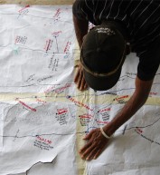
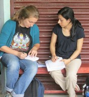
Using this approach, Pact, with support from USAID, launched the Godere Forest Initiative. Through the initiative, Pact trained community members and equipped them with tools and materials, including GPS, to conduct assessments. Over the course of several weeks in the summer of 2016, community members assessed forest resources in three kebeles (communities), representing 10,500 hectares (about 26,000 acres).
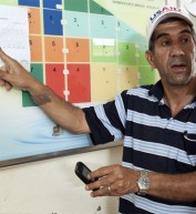
The results included detailed inventories of tree species and their conditions, maps of each forest plot, and recommended actions for each kebele. Reflecting on the process, one community member noted, “The forest is ours, but we did not know what was inside. This assessment helped us to see what we have and what we do not have in our own forest.”
As a result of the assessments and mapping, forest communities used the information to develop management plans that outline how they will protect and generate income from the forest—for example, selling old and dying trees, and engaging in forest-friendly non-timber activities like honey and spice production. With the management plans, community groups received formal certificates from the regional government giving them authority to co-manage the forests. This process involved training and active participation of the local community members—including elders and government representatives—and this effort will be replicated in other areas after the Godere initiative concludes.
Moving forward, with the authority and knowledge of their forests’ resources and boundaries, communities are empowered and better equipped to stop encroachment and deforestation by others, and to benefit from their forests’ resources.
Follow @USAIDEthiopia on Facebook, on Flickr, on YouTube


Comment
Make a general inquiry or suggest an improvement.